The Outcomes Document of the Pacific Islands Conference on Ocean Science and Ocean Management is now available. All participants are welcome to use it in their work.
The Pacific now has a Ocean Decade Collaborative Centre!
The Pacific Islands Ocean Decade Collaborative Centre hosted at SPC-PCCOS is the regional coordination and collaboration unit to oversee and facilitate the implementation the UN Decade of Ocean Science for Sustainable Development in the Pacific.
The Pacific Community (SPC) is the premier scientific organisation in the Pacific, providing advice to member countries and territories on a broad range of topics. The Pacific Community Centre for Ocean Science (PCCOS) is a coordination unit for ocean science at SPC and in the region, connecting people and partners to help Pacific Island governments and communities easily access the ocean science and expertise they need to make informed decisions to protect and sustainably manage ocean resources.
The Project is focused on developing innovative forecast solutions and ocean monitoring for Pacific Island countries and territories. This project was developed and tested in Fiji in areas with low-lying coastlines at risk of coastal inundation. Our Oceanography team delivered one of the key components of the CIFDP project focused on developing swell-driven coastal inundation forecasting and modelling.
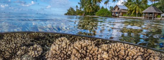
PACPATH is a Belmont Forum Collaborative Research Action (CRA). The project builds on a multi disciplinary and multi actor consortium to co-design a robust Ocean research strategy, projects and services to develop coastal and offshore ocean sciences, ocean stewardship and prototype innovative sustainability pathways.
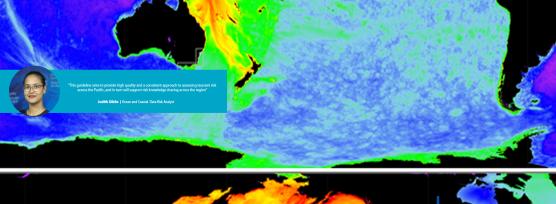
Geoscience Australia (GA) and the Pacific Community (SPC) partnered towards the development of a peer-reviewed guideline to assess tsunami inundation hazards in the Pacific Island region. The guideline leverages and optimizes the use of GA's 2018 Probabilistic Tsunami Hazard Assessment (PTHA18) and aims to provide member countries, technical partners, and consultants with methodologies and tools to support hight quality standard for earthquake-generated tsunami hazard assessment across the region.
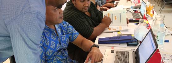
We work with our Pacific Island counterparts to build tools to forecast and report on climate, tides, sea level and ocean conditions. At the same time, we work with them to determine how best to communicate this information to communities, businesses and governments to improve preparedness and decision-making.
As part of the Climate Risk Early Warning Systems (CREWS) initiative led by World Meteorological Organisation (WMO), SPC's Oceanography Team is developing and implementing high-resolution wave and inundation early forecast systems with the countries of Tuvalu and Kiribati. The systems are developed to the national context to provide accurate, timely and actionable forecast information to support safety at sea, tourism and disaster risk reduction for the communities of Tuvalu and Kiribati
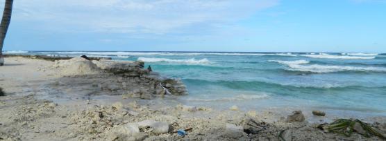
To support science-based coastal protection solutions and to provide nationwide coastal risk information to develop effective adaptation strategies relevant to Tuvalu communities. The application of this work will help inform best-practice approaches to address the challenge posed by climate change, sea-level rise and wave inundation risk.
The SPC component of the PREP programme include a combination of activities and investments that would improve resilience of the participating countries and Pacific region to natural hazards by improving forecasting and disaster preparedness. The activities implemented to strengthen early warning including the related modelling work for coastal inundation in Marshall Islands, Tonga and Samoa is groundbreaking research jointly implemented with leading international scientists.